Culasi Bypass
Inland high-speed bypass around Culasi — safety, hospital access, and a bankable local proof of concept (~₱1.0–1.4B ROM).

Antique west-coast road programme — Phase 1 is the Culasi Bypass.
Progressive road corridor that starts locally in Culasi, scales across Antique Province, and eventually ties into island-wide connectivity — including linkage to the Panay–Guimaras–Negros (PGN) bridging programme.
Phase 1 comes first: the Culasi Bypass is the proof of concept — relieve through-traffic, protect the poblacion, give Culasi District Hospital a fast interchange, then unlock the Antique Expressway spine.
Inland high-speed bypass around Culasi — safety, hospital access, and a bankable local proof of concept (~₱1.0–1.4B ROM).
Province-scale inland spine ~San Jose → Pandan / Nabas, including the Tibiao–Culasi marine viaduct package (~₱74B full corridor ROM).
West Panay connectivity into Aklan / Capiz via Panay Trunkline (Kalibo / Roxas / Iloilo) and the future PGN trunk.
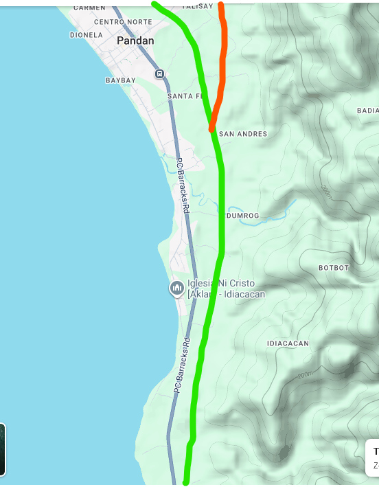
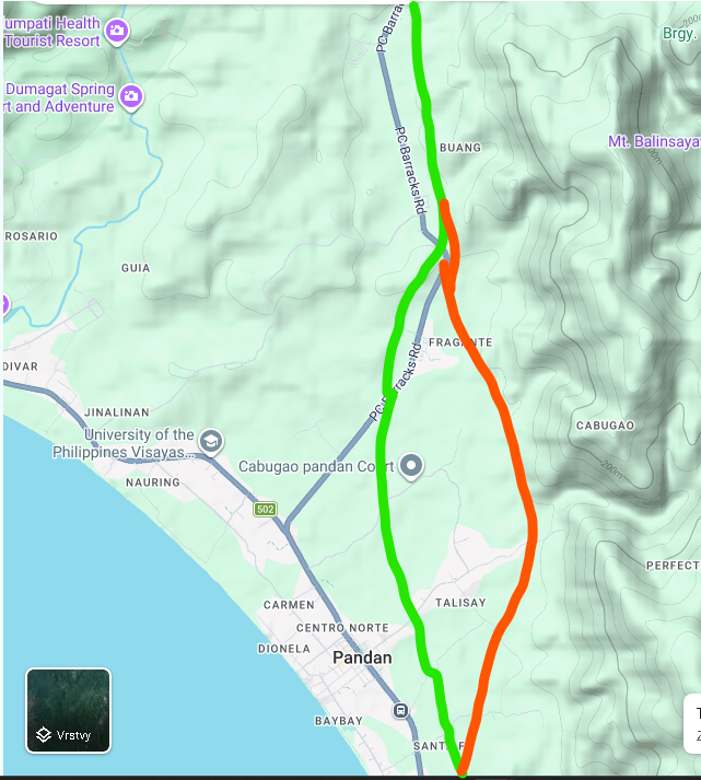
Interactive alignment of the Antique inland corridor from San Jose de Buenavista (Atabay) through Culasi to Pandan Norte / Nabas (Aklan border). Green = preferred main spine · orange = eastern Pandan bypass (Fragante–Talisay). Polylines: Culasi and Barbaza–Tibiao = GPS waypoints; other municipalities still conceptual until GPS arrives.
Click a municipality to zoom to that segment only · click again (or All) to show the full corridor. Culasi = Phase 1 GPS bypass. Click the map once to enable scroll zoom.
Today, west-coast transit mixes trucks, provincial buses, tricycles and pedestrians inside town centres (often 30–40 km/h). Iloilo → Culasi / Kalibo / Caticlan commonly takes 6–8 hours. Passage through Culasi alone can cost 20–30 minutes of slow, hazardous driving on a typhoon- and landslide-exposed coastal National Highway.
Phase 1 pulls long-haul traffic out of the poblacion onto a closed inland corridor (~8 km, design speed 80–100 km/h) so town passage drops toward <5 minutes.
Ground-level bypasses in the Philippines often get rebuilt as strip malls within a few years and lose their transit function. Early concepts therefore used an elevated skyway with a single interchange near Culasi District Hospital — grade separation, flood clearance, and no mid-town exits for heavy trucks.
The preferred refined alignment keeps that closed-system logic but follows the inland green route via the Naba pass with a cut-and-cover gallery (not a deep bored tunnel): lower CapEx, typhoon/landslide resilience, still bridged/elevated where floods matter.
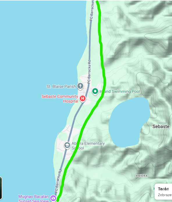
Inland high-speed bypass: south terminus 11.377550°N, 122.062078°E (Batonan / highway rejoin) → north terminus 11.503113°N, 122.090851°E (Bitadton / highway leave). Alignment stays clear of the poblacion and keeps a direct line for through traffic. Waypoints below are GPS (not a surveyed centerline).
| # | Lat (°N) | Lon (°E) | Note |
|---|---|---|---|
| S | 11.377550 | 122.062078 | South terminus — rejoin national highway |
| 1 | 11.378026 | 122.064055 | |
| 2 | 11.381595 | 122.065002 | |
| 3 | 11.384333 | 122.064342 | |
| 4 | 11.391950 | 122.064372 | |
| 5 | 11.405202 | 122.062634 | |
| 6 | 11.412290 | 122.060402 | |
| 7 | 11.422870 | 122.063750 | |
| 8 | 11.437697 | 122.071152 | Hospital / mid corridor area |
| 9 | 11.445353 | 122.071914 | |
| 10 | 11.453849 | 122.074006 | |
| 11 | 11.460978 | 122.078598 | |
| 12 | 11.473512 | 122.077998 | |
| 13 | 11.489872 | 122.090228 | |
| N | 11.503113 | 122.090851 | North terminus — leave national highway |
| Segment | Alignment intent |
|---|---|
| North start | Leave National Highway near Bitadton (11.503113, 122.090851) |
| Corridor | Inland of poblacion — avoid settlements; keep as straight as practical for speed |
| Mid | East of Centro / hospital catchment (single interchange later) |
| South end | Rejoin National Highway near Batonan (11.377550, 122.062078) |
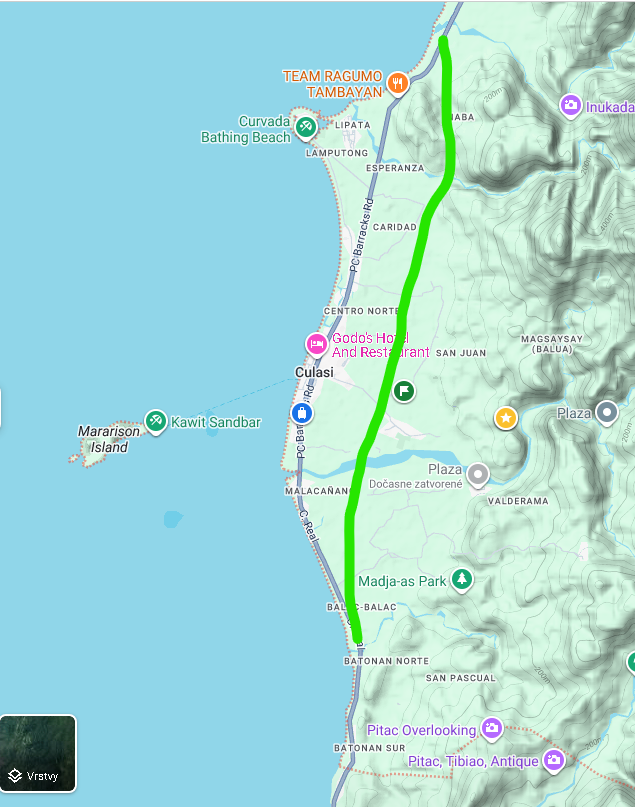
Follows the low Naba pass just inland of the coastal plain; gallery instead of bored tunnel; smoother fall toward hospital / Camancijan; lower CapEx and ROW conflict. Stays east of Poblacion / Centro Norte–Sur.
Higher inland ridgelines (~100–200 m), deep valleys, costly bridges/viaducts, higher landslide/scour risk; earlier ideas included a bored tunnel.
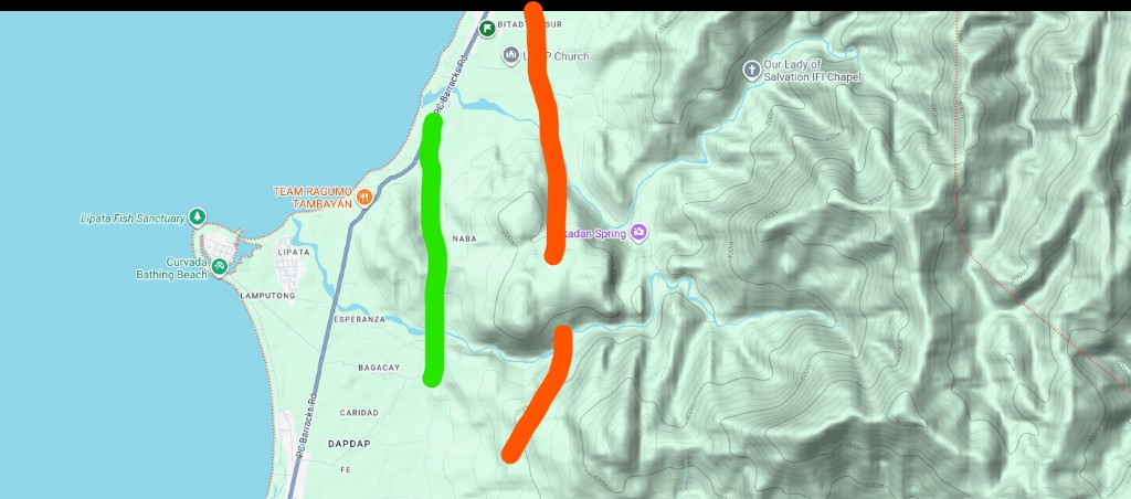
Phase 1 is sized so Culasi can own the political start without waiting for a ₱74B province package — then escalate with a working local alignment and resolution in hand.
Indicative ROM figures from the conceptual study (not a formal NEDA feasibility study).
| Scope | CapEx (ROM) |
|---|---|
| Phase 1 — Culasi Bypass | ₱1.0–1.4 billion |
| — Naba gallery | ₱200–350M |
| — River bridge + viaducts | ₱300–450M |
| — Earthworks, pavement, drainage, ROW | ₱400–600M |
| Full Antique corridor (~95 km) | ~₱74.0 billion |
After the Culasi Bypass proves the corridor logic, Phase 2 packages the province spine. Construction packages studied for the ~95 km Antique Inland Expressway (ROM ~₱74B):
| Build package | Length | Focus | CapEx (₱B) |
|---|---|---|---|
| San Jose – Patnongon | ~22 km | Southern priority corridor | 12.5 |
| Tibiao – Culasi marine viaduct | ~5 km | Coastal bottleneck clearance | 18.0 |
| Patnongon – Tibiao inland | ~45 km | Inland bridges & Barbaza hospital spur | 28.0 |
| Culasi – Pandan / Nabas | ~23 km | Northern link toward Aklan | 15.5 |
| Total corridor ROM | ~95 km | ~74.0 |
Travel-time claim for the completed spine: Culasi ↔ San Jose from ~2.5 hours toward ~52 minutes; Pandan ↔ San Jose from >3 hours toward ~1 h 10 min. Phase 3 then frames the western leg toward Caticlan / Boracay and the future PGN bridges.
Tibiao–Culasi coastal pinch — marine viaduct alternative vs inland options (maps 11–12).
Panay–Guimaras–Negros Bridge programme — future external connection for Phase 3 narrative.
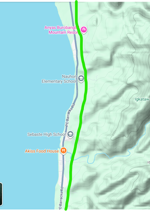
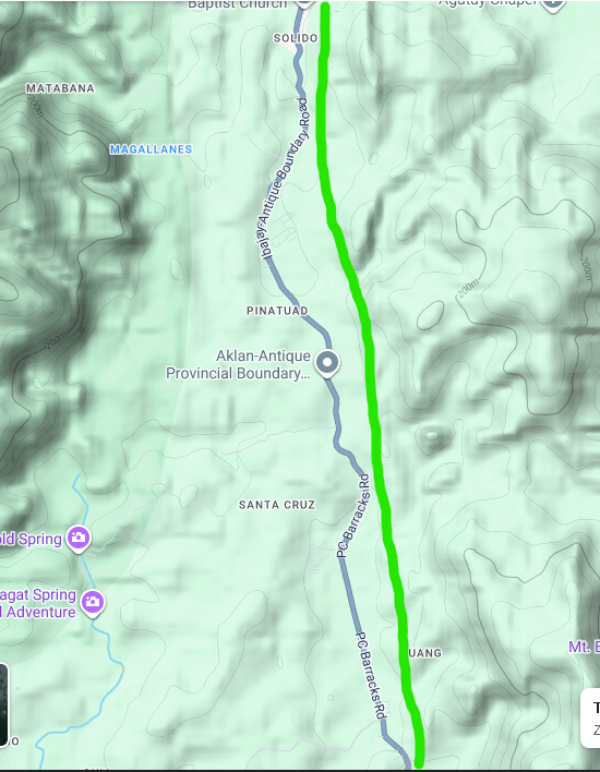
Google Maps Terrain screenshots. Green = preferred inland corridor · Orange = alternative.
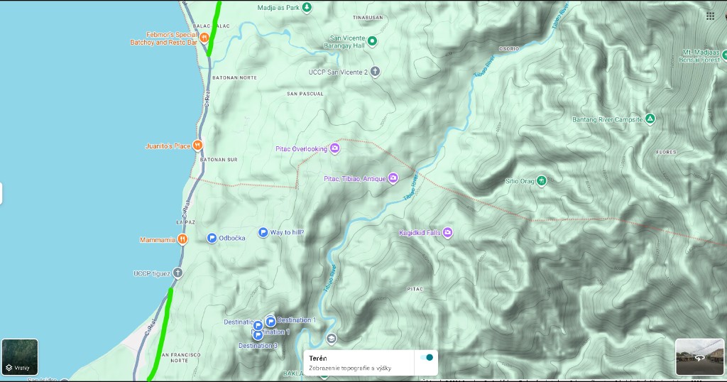
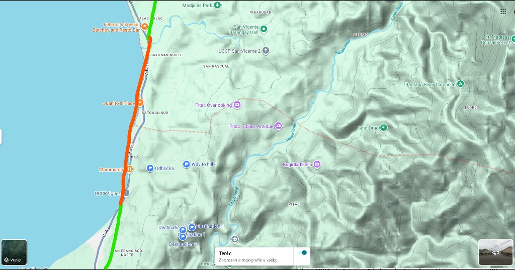
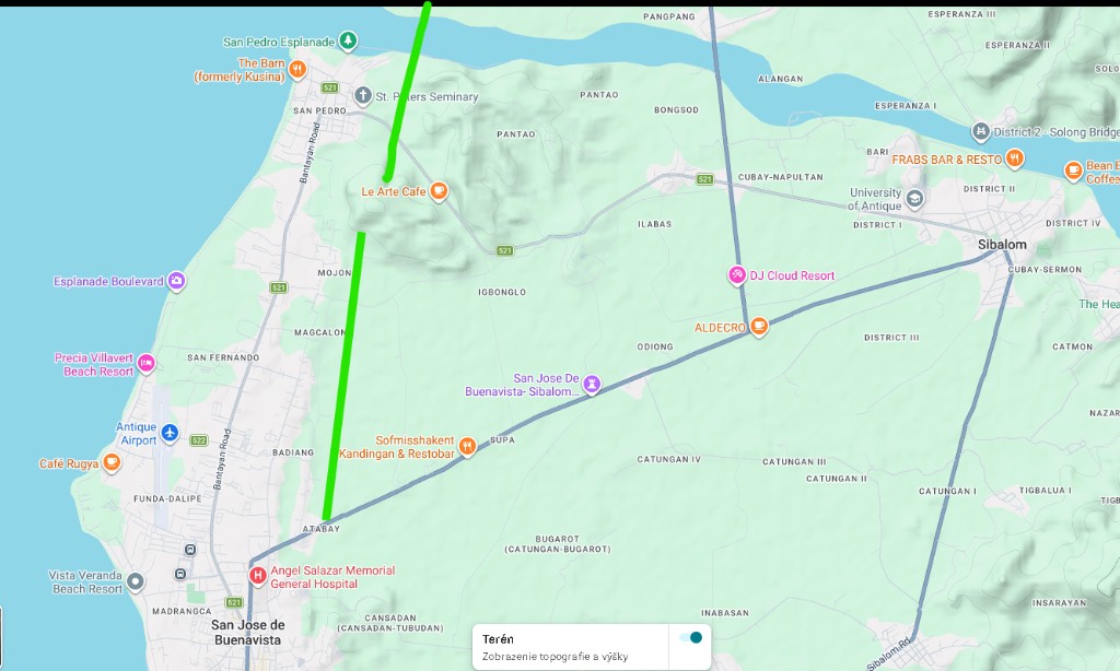
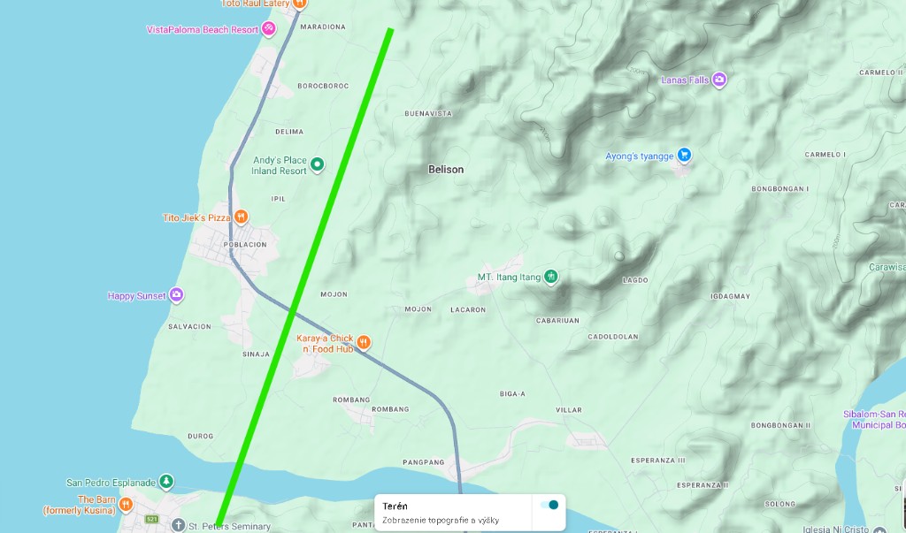
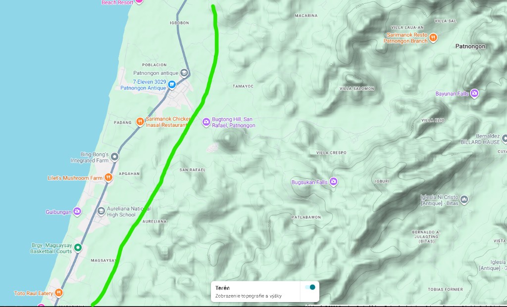
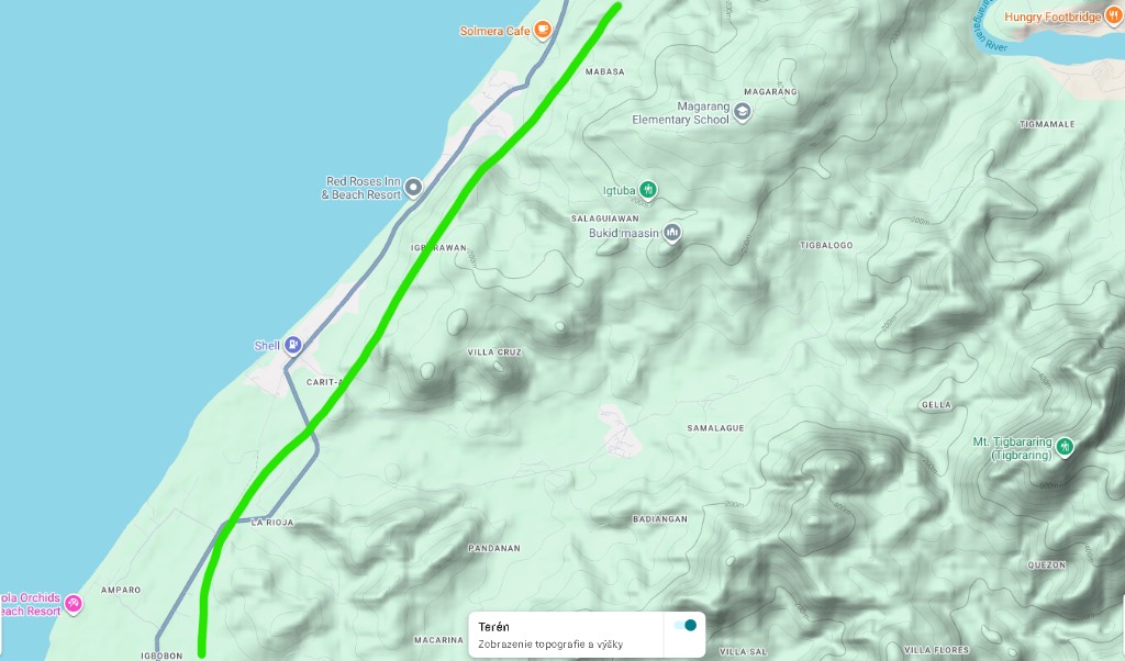
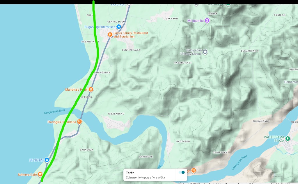
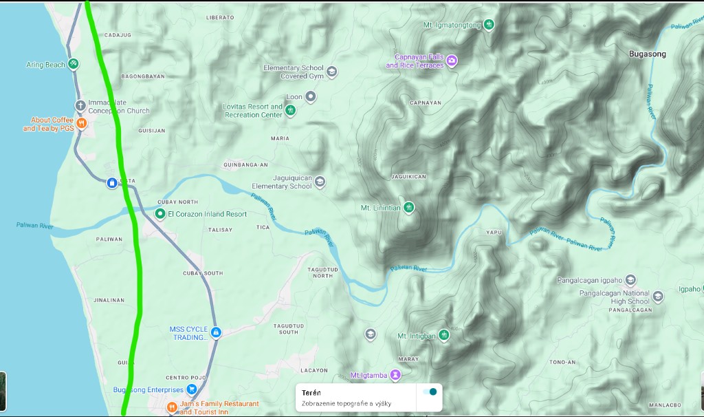
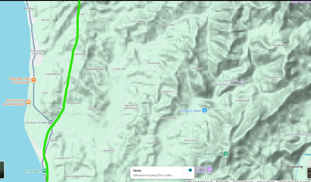
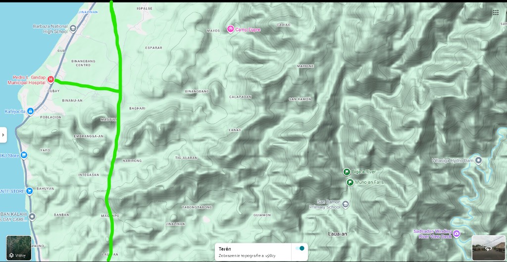
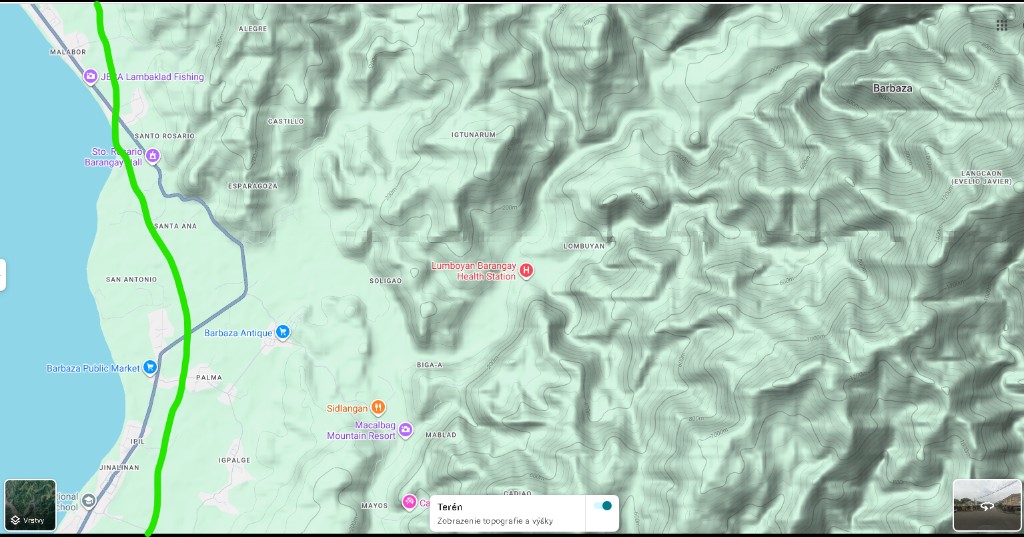
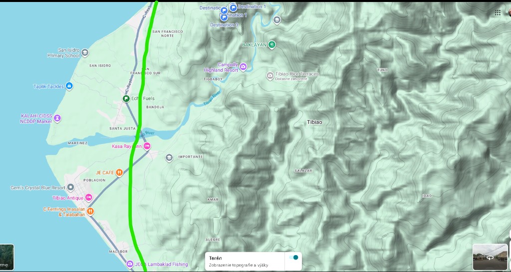
Continuation north of Culasi — source folder Culasi - Pandan. Green inland spine · orange Fragante–Talisay alternative where shown.
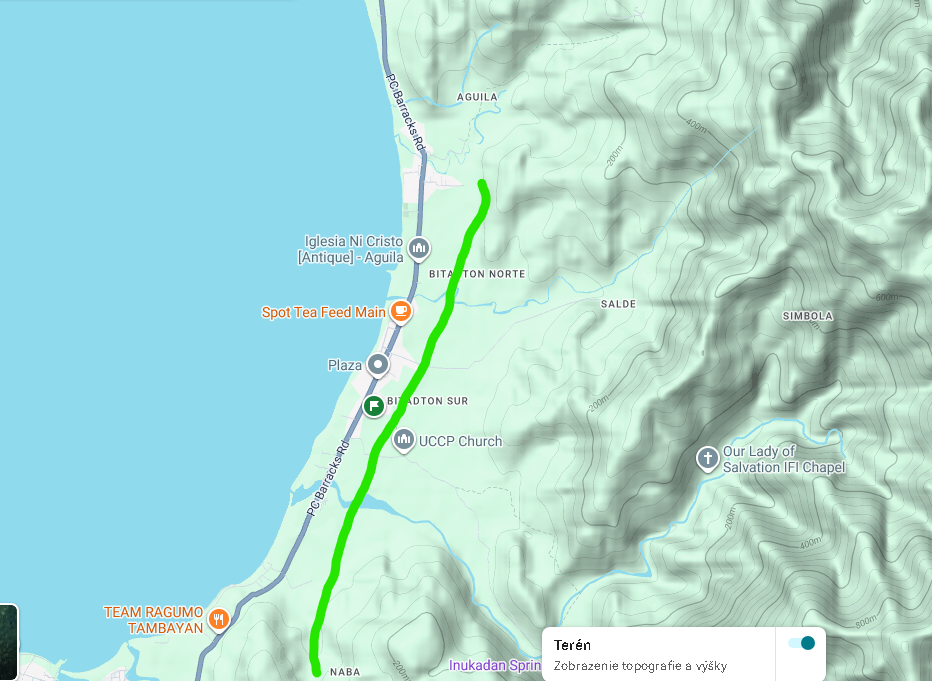
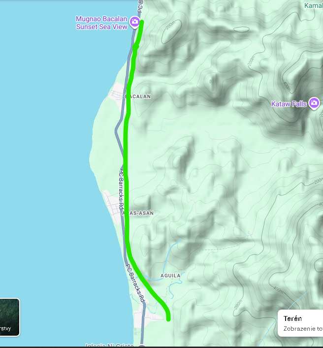
Continues as Panay Trunkline maps from Nabas into Aklan / Capiz.